// BLOG // Baden-Württemberg and Rheinland-Pfalz now available
Finally: Baden-Württemberg and Rhineland-Palatinate are now also making their geodata available as OpenData and we can finally include them in our services.
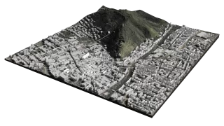
Using our interactive Map you now have direct access to:
Terrain models (DGM1)
LoD2 buildings
Orthophotos (DOP20)
Parcels from the ALKIS (Cadastre)
You can download everything for any sections in one package, e.g. as a DXF file, and import it immediately into your CAD software to put your project into context.